banner-normandy

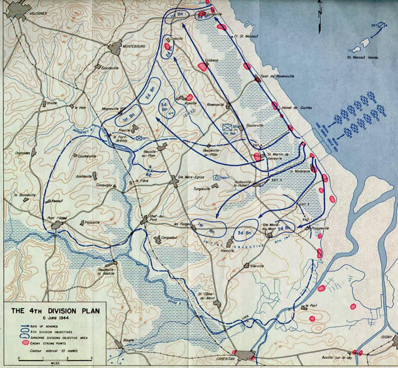
Utah beach (La Madeleine)

This pole marks the landing area of Utah beach. It is the start of the Liberty Road with milestones through France. It is here that Theodore Roosevelt comes to shore with his men. The planned landings should take place at 2km higher at ‘La Grande Dune’ but he ended up at La Madeleine, where there is little resistance. 

Utah Beach Milestone Km 00

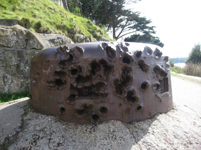
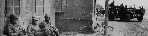
From 1942 to June 1944, the old fisherman’s hut sheltered by dunes, what is now Roosevelt Café was used for the German Todt organization.  Right next to the house was a bunker found by the Germans was used as a communication post. A nice comparison photo is to be made of a former bunker now a restaurant.

The main building became immediately after D-Day the U.S. Army 1st Engineer Special Brigade Communications Group accommodations. Between June and November 1944 the bunker was used as a communications center for the U.S. Navy, who oversaw the traffic between the fleet and the front. The 39 radio operators of the Command Task Group supported the NOIC (Naval Officer In Charge).

Utah Beach blockhouse

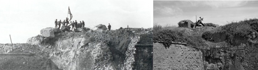
From the bunker, which is part of the Restaurant section are dated WW2 photos to find. The side view of the bunker still has two black / white painted windows as on the pictures to see that just after D-Day were taken. Mr. Methivier has made to his life’s work to identify veterans who during WW2 where living in his building . Behind large plexiglass sheets are handwritten messages to see soldiers who left behind their traces here just after D-Day.

Today behind the bunker a restaurant is situated: www.leroosevelt.fr

Read more

Sainte-Mère-Église

sainte_mere_eglise_parachutiste

The town’s main claim to fame is that it played a significant part in the World War II Normandy landings because this village stood right in the middle of route N13, which the Germans would have most likely used on any significant counterattack on the troops landing on Utah and Omaha Beaches. In the early morning of 6 June 1944 mixed units of the U.S. 82nd Airborne and U.S. 101st Airborne Divisions occupied the town in Operation Boston, giving it the claim to be one of the first towns liberated in the invasion.

Later that morning, about 0500, a force led by Lt. Colonel Edward C. Krause of the 505th PIR took the town with little resistance. Apparently the German garrison was confused and had retired for the rest of the night. However, heavy German counterattacks began later in the day and into the next. The lightly-armed troops held the town until reinforced by tanks from nearby Utah Beach in the afternoon of June 7

Church of Sainte-Mère-Église
Read more

Saint-Malo

Saitn Malo - Turret

Grenade damaged turret

In the Second World War, Saint-Malo and Saint-Servan where part of the German defense and fortification system extending from Cancale (on the west coast of the bay of Mont Saint-Michel) to the mouth of the Fremur at Saint-Briac-stretched sur-Mer. The centerpiece of the defense system was the Cité d’Aleth peninsula. In addition, the main defense supports the small rocky island of Grand Be, more than 300 meters northwest of the Tour Bidouane, the approximately 3.5 km furthernorthwest island Cézembre and the Pointe de la Varde. After the landing of the Allies in Normandy on 6 June 1944, the old Saint-Malo Intra-Muros, or Ville Closealso said city, for more than 70% destroyed. It was rebuilt after the war, mostly in the original 18th century style.


On August 6th the Germans demolished all the quays, locks, breakwaters and machinery in the harbour area in order to prevent a working harbour falling in to the hands of the approaching U.S. Army. The ancient city fortress had been heavily reinforced with concrete and and so the battle to take it was extremely difficult, and required heavy fighting to conquer these fortified German strongholds. The thick walls designed to withstand medieval siege proved effective against the modern artillery of the 83rd.

staint malo fortress

Saint Malo – Fortress

Read more

Port en Bessin

Port en Bessin - Tour Vabbin

Port en Bessin was the actual linkup point between the American and British forces on June 7, 1944. The American 16th Infantry Regiment had landed on the Easy Red Sector on Omaha Beach and fought its way along the coastal towns to link up with the 47th Royal Marine Commandos, which had struggled its way from Gold Beach. 

The Royal Marines fought a difficult battle to take the town and its eastern and western fortifications. The Royal Marines finally took the town after fighting house-to-house and knocking out the harbour defenses, which included pillboxes and a flak boat of the German Navy. The 16th Infantry Regiment took the part of town called Huppain and liberated the area now known as the Omaha Beach Golf Club.

Port en Bessin Jarbor
Read more

Neerpelt bridge

Neerpelt Bridge
Neerpelt bridge start of operation Market Garden

The original bridge had been destroyed by the Belgian Army in 1940, but the Germans had constructed a wooden Pontoon bridge to the west of it. This bridge was taken on the evening of 10 September 1944 by the Irish Guards under the command of Lieutenant-Colonel J.O.E Vandeleur. While the Welsh Guards engaged the German forces around Hechtel, the Irish Guards advanced rapidly north-east through the villages of Eksel, Overpelt and Neerpelt, and launched their combined infantry-tank assault, with artillery support, from the grounds of the zinc processing factory in Overpelt. They succeeding in taking the bridge undamaged.

1 7 8 9 10 11